Saturday, December 24, 2022

Happy Holidays 2022

 1906 advertisement for Londonderry Lithia Water


---------------------------

Heather Wilkinson Rojo, "Happy Holidays 2022", Nutfield Genealogy, posted December 24, 2022, ( https://nutfieldgenealogy.blogspot.com/2022/12/happy-holidays-2022.html: accessed [access date]). 

Tuesday, December 20, 2022

A Walk Through Abandoned Monson, New Hampshire

Ten years ago I posted a similar story about a walk through Monson.  It was time for another walk... (see my post at https://nutfieldgenealogy.blogspot.com/2012/09/the-abandoned-town-of-monson-new.html


Monson was a town in southern New Hampshire between the 1730s and 1770s, originally part of the state of Massachusetts, but it became part of New Hampshire in 1746.  It was abandoned, and this site now belongs to the two towns of Hollis and Milford, New Hampshire.  It is like stepping back into time.  There are no signs of anything modern except for the information kiosk at the entrance.  All that exists are stonewalls, and one surviving homestead, the Gould house.  This land was donated by Russ and Geri Dickerman. 


There are thriving chestnut trees along the road into Monson Center.  


The Gould House is a small home in the center of Monson, open by chance or by appointment by. We were lucky, Russ Dickerman and his friends were there for a clean up day, and we were able to peek inside for the first time. We also met his dog, Niki II.  


We walked through the fields and forest along these roads and paths to see the cellar holes (which are well marked) for families such as the Wallingford, Brown, Nevins, and Bayley families. There is a stone enclosure that was an animal pound. 


Russ Dickerman's dog, Niki, is buried along the stone wall that circles the meadow. 


Across from the Gould homestead is the cellar hole for another home.  There is a photo of this home, and inside the Gould house is a painting of this home in the early 20th century when a family lived here.  The man who owned this home was Russ Dickerman's uncle. 


This map is on the kiosk at the entrance to Monson Center,
and it is also available online (see the link below)

-----------------

For the truly curious:

The Abandoned Town of Monson, New Hampshire, 2012   https://nutfieldgenealogy.blogspot.com/2012/09/the-abandoned-town-of-monson-new.html   

Society for the Protection of New Hampshire Forests, Monson Center:   https://forestsociety.org/property/monson-center  

Map of Monson Center:      https://forestsociety.org/sites/default/files/Monson%20Village%20Map.pdf  

I've blogged about exploring other "ghost towns" - Monson, NH; Dogtown, MA; Chinese Camp, CA; and Zealand, NH.  You can find them at this link:   https://nutfieldgenealogy.blogspot.com/search/label/ghost%20town  

New Hampshire Magazine, "The Mystery of Monson", 2019:     https://www.nhmagazine.com/the-mystery-of-monson/  

-------------------------

To cite/link to this blog post: Heather Wilkinson Rojo, "A Walk Through Abandoned Monson, New Hampshire", Nutfield Genealogy, posted December 20, 2022, ( https://nutfieldgenealogy.blogspot.com/2022/12/a-walk-through-abandoned-monson-new.html: accessed [access date]). 

Thursday, December 15, 2022

Edmund Littlefield's Grist and Saw Mills, Wells, Maine

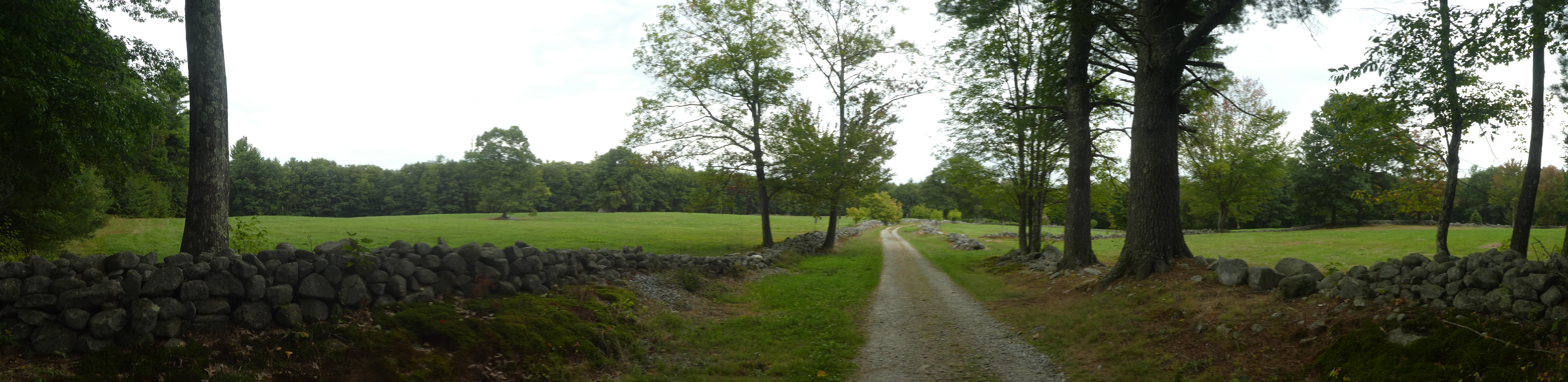
Webhannet Falls, Wells, Maine
Where Edmund Littlefield was granded land for a 
grist and saw mill in 1643


Edmund Littlefield (1592 - 1662), my 10th great grandfather, is called "The Father of Wells, Maine".  Edmund was baptized in Titchfield, Hampshire, England on 22 June 1592.  He arrived in Boston in 1635 with his two sons, and his wife and six more children arrived in 1638 on board the ship Bevis.  Edmund Littlefield was in New Hampshire to sign the Exeter Combination in 1639, and in 1643 he joined Rev. John Wheelwright on the coast of Maine, in what is now Wells, Maine. 

This little wayside marker for Edmund Littlefield's mill is next to the Webhannet Falls on the side of Route 1, south of 876 Post Road. There is room to pull off the road and park to explore this site. 

Edmund Littlefield was granted this land from Thomas Gorges, son of Sir Ferdinando Gorges on 14 July 1643.  [NEHGS Register 105:262].   There appears to be a time discrepency between his land grant for the mill on the river, and the sign mounted on the boulder (see below). 


RECOGNITION OF THOSE WHO MADE PARK POSSIBLE
Wells Town Officials                        Goodspeed Family   
June & Roger Messier                            Gray Farms       
Elizabeth & Bruce Parker                     Hayway Vales    
Ester Miller                                         Jo-Ann's Gardens
Cindy Brockway                           Nickersons 9B Ranch
Gail Lynde                                           Garden Club       
Wells Highway Dept.                           Wells Rotary      
Historical Society


THE FIRST PERMANENT SETTLEMENT
OF WELLS WAS AT THIS SITE WHEN IN
1640/41 EDMUND LITTLEFIELD ERECTED
HIS SAW & GRIST MILLS


For the truly curious:

Wells [Images of America Series], by Hope M. Shelly, Arcadia Publishing, Dover, NH, 1996, page 7.

The Historical Society of Wells and Ogunquit, Maine - Littlefield Gallery webpage:   https://www.wellsogunquithistory.org/littlefield  

My blog post on Edmund Littlefield for Surname Saturday (showing my lineage):   https://nutfieldgenealogy.blogspot.com/2019/01/surname-saturday-littlefield-of-wells.html    

Tombstone Tuesday, Josiah Littlefield, buried in Wells, Maine:    https://nutfieldgenealogy.blogspot.com/2022/07/josiah-littlefield-d-1713-wells-maine.html  

-------------------------------------

To cite/link to this blog post:  Heather Wilkinson Rojo, "Edmund Littlefield's Grist and Saw Mills, Wells, Maine", Nutfield Genealogy, posted December 15, 2022, ( https://nutfieldgenealogy.blogspot.com/2022/12/edmund-littlefields-grist-and-saw-mills.html

Wednesday, December 7, 2022

Wells, Maine Town Hall - Weathervane Wednesday

 Today's weathervane was photographed over the Town Hall, 208 Sanford Road, Wells, Maine.


This terrific weathervane is a highly detailed three masted ship with white sails.  It is located on the cupola above the Wells Municipal Building or town hall.  The original meetinghouse was a small wooden building built in 1662, which burned in 1692 during a raid by the indigenous people of the area.  A second meetinghouse was built in 1699, and a third one in the 1770s.  The current meetinghouse was built in 1862 as a church known as the First Congregational Church of Wells,  and is now used by the Historical Society. 

The Wells Municipal Offices Building was built in the 1960s.  There were several previous town halls built in the 1800s and 1900s after town government separated from the churches.  Most "meetinghouses" in New England were formerly used as churches.


For the truly curious:

The Town of Wells, Maine   https://www.wellstown.org/  

The Historical Society of Wells and Ogunquit, Maine  https://www.wellsogunquithistory.org/  

Click here to see nearly 500 weathervane blog posts:

---------------------------

To cite/link to this blog post:  Heather Wilkinson Rojo, "Wells, Maine Town Hall - Weathervane Wednesday", posted December 7, 2022, ( https://nutfieldgenealogy.blogspot.com/2022/12/wells-maine-town-hall-weathervane.html: accessed [access date]).