Showing posts with label Monson. Show all posts

Tuesday, December 20, 2022

A Walk Through Abandoned Monson, New Hampshire

Ten years ago I posted a similar story about a walk through Monson.  It was time for another walk... (see my post at https://nutfieldgenealogy.blogspot.com/2012/09/the-abandoned-town-of-monson-new.html


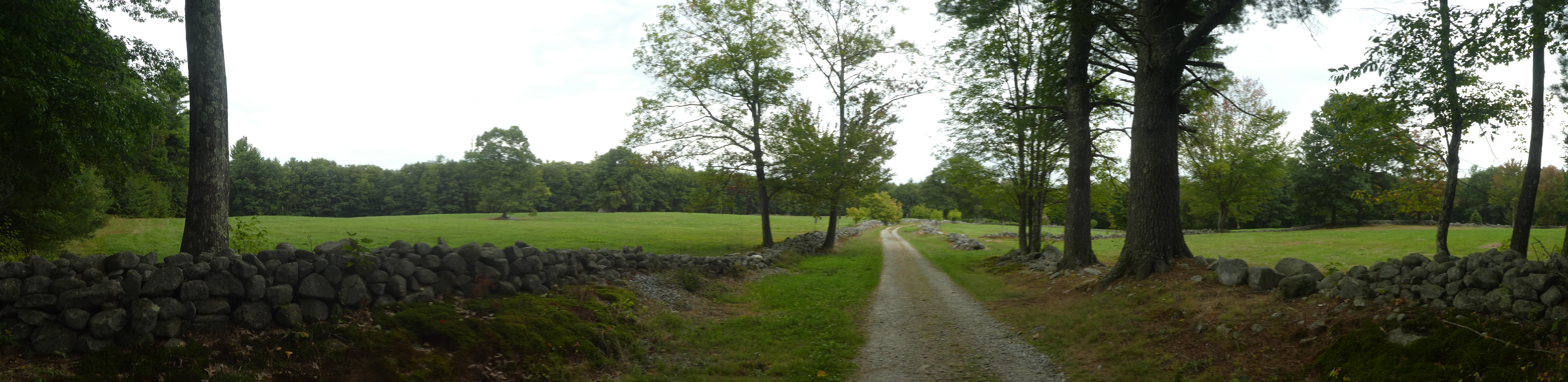
Monson was a town in southern New Hampshire between the 1730s and 1770s, originally part of the state of Massachusetts, but it became part of New Hampshire in 1746.  It was abandoned, and this site now belongs to the two towns of Hollis and Milford, New Hampshire.  It is like stepping back into time.  There are no signs of anything modern except for the information kiosk at the entrance.  All that exists are stonewalls, and one surviving homestead, the Gould house.  This land was donated by Russ and Geri Dickerman. 


There are thriving chestnut trees along the road into Monson Center.  


The Gould House is a small home in the center of Monson, open by chance or by appointment by. We were lucky, Russ Dickerman and his friends were there for a clean up day, and we were able to peek inside for the first time. We also met his dog, Niki II.  


We walked through the fields and forest along these roads and paths to see the cellar holes (which are well marked) for families such as the Wallingford, Brown, Nevins, and Bayley families. There is a stone enclosure that was an animal pound. 


Russ Dickerman's dog, Niki, is buried along the stone wall that circles the meadow. 


Across from the Gould homestead is the cellar hole for another home.  There is a photo of this home, and inside the Gould house is a painting of this home in the early 20th century when a family lived here.  The man who owned this home was Russ Dickerman's uncle. 


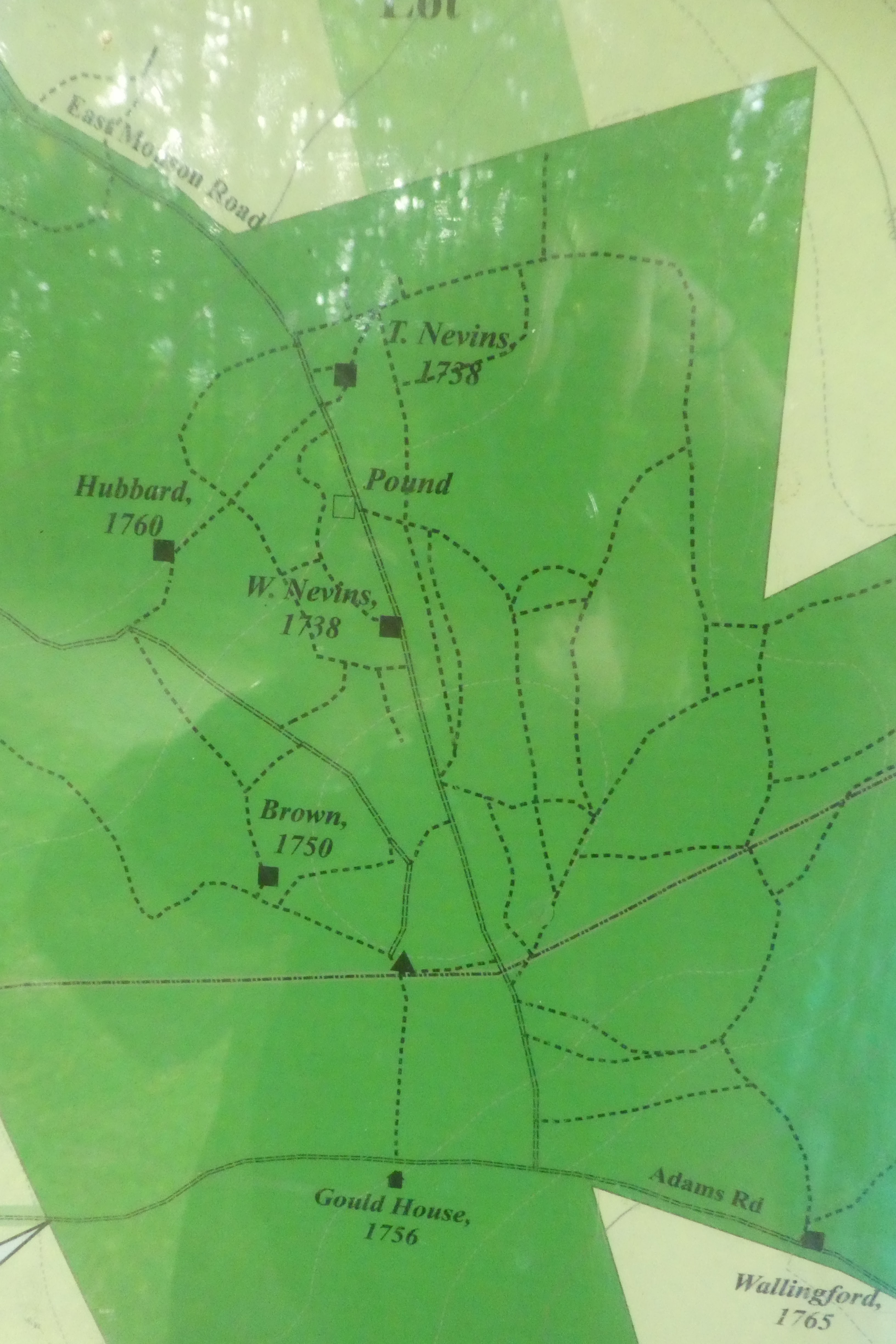
This map is on the kiosk at the entrance to Monson Center,
and it is also available online (see the link below)

-----------------

For the truly curious:

The Abandoned Town of Monson, New Hampshire, 2012   https://nutfieldgenealogy.blogspot.com/2012/09/the-abandoned-town-of-monson-new.html   

Society for the Protection of New Hampshire Forests, Monson Center:   https://forestsociety.org/property/monson-center  

Map of Monson Center:      https://forestsociety.org/sites/default/files/Monson%20Village%20Map.pdf  

I've blogged about exploring other "ghost towns" - Monson, NH; Dogtown, MA; Chinese Camp, CA; and Zealand, NH.  You can find them at this link:   https://nutfieldgenealogy.blogspot.com/search/label/ghost%20town  

New Hampshire Magazine, "The Mystery of Monson", 2019:     https://www.nhmagazine.com/the-mystery-of-monson/  

-------------------------

To cite/link to this blog post: Heather Wilkinson Rojo, "A Walk Through Abandoned Monson, New Hampshire", Nutfield Genealogy, posted December 20, 2022, ( https://nutfieldgenealogy.blogspot.com/2022/12/a-walk-through-abandoned-monson-new.html: accessed [access date]). 

Wednesday, January 16, 2013

Weathervane Wednesday ~ An Abandoned Town


This is part of an on-going series of photographs of weather vanes in New Hampshire.  I started by documenting the weather vanes in the Nutfield area (formerly Derry, Londonderry and Windham, New Hampshire) but I've spread out to other areas now.  Some of the weather vanes are historical, some are whimsical, and all are interesting.  Today's weather vane is located in a "ghost town" or abandoned town in Southern New Hampshire.

Do you know the location of weather vane #78?  Scroll down to see the answer!


The Joseph Gould House

Interior (photographed through the window!)

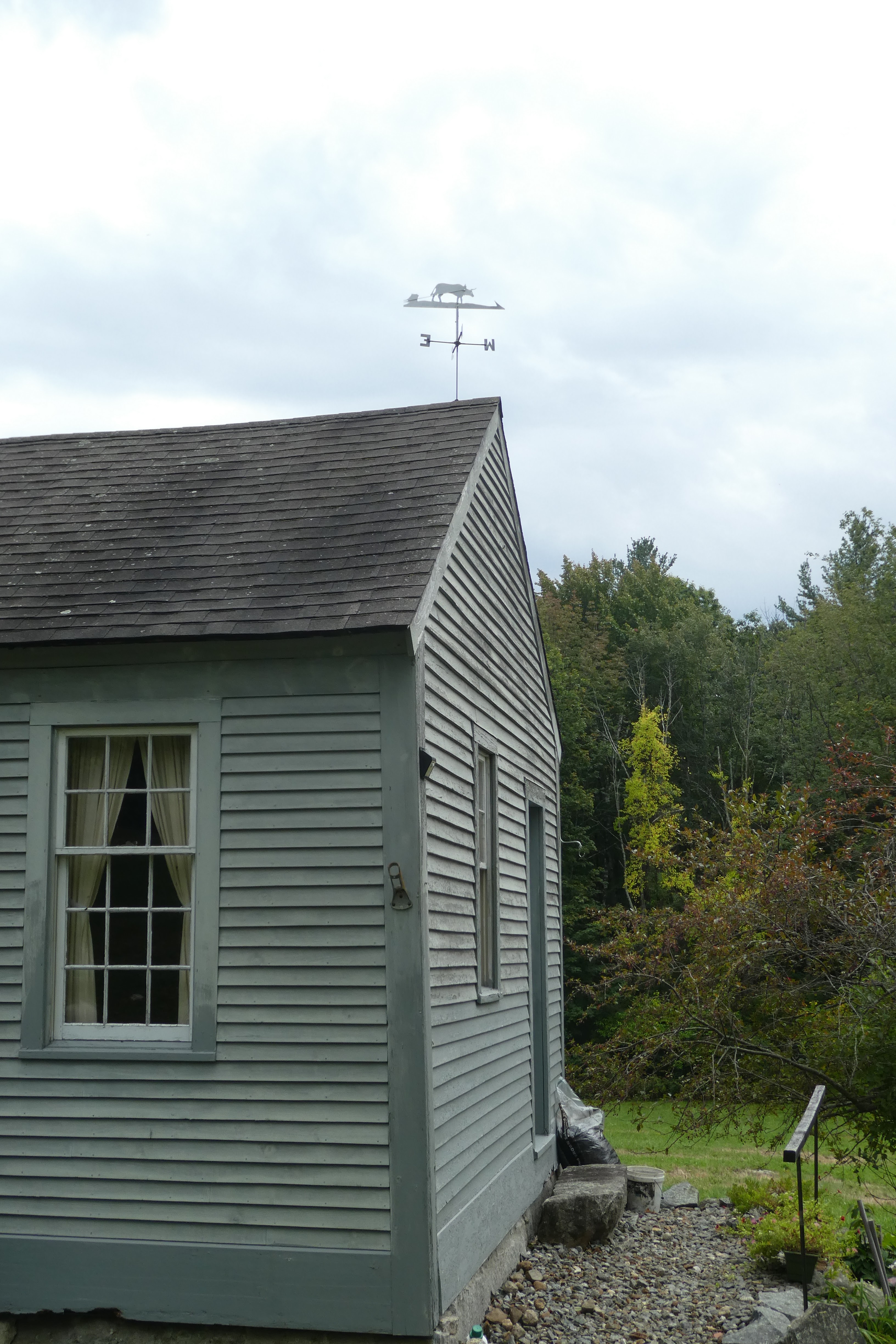
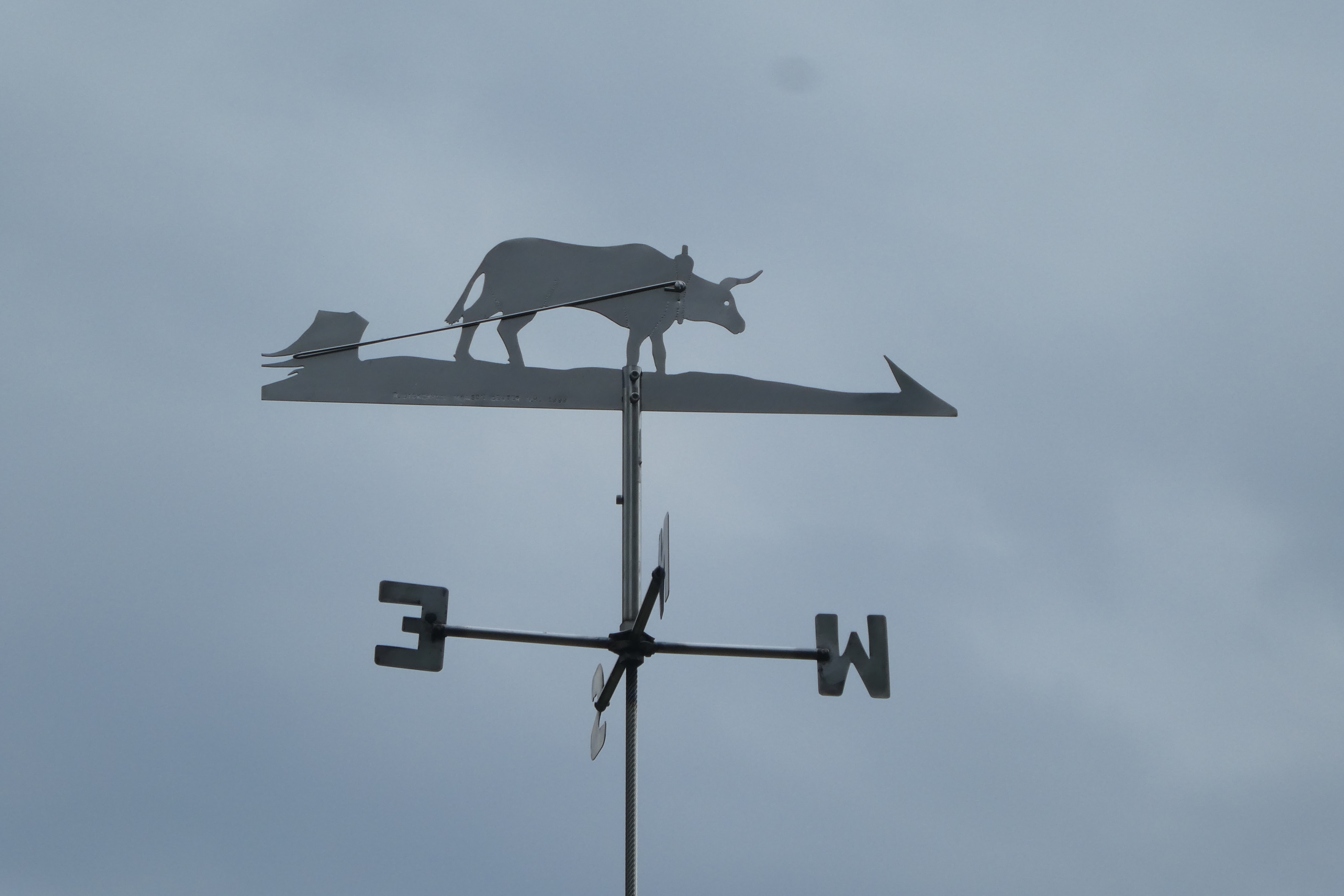
This weather vane is located on the Joseph Gould house in Monson, New Hampshire.  Monson is an abandoned town that straddles the Hollis and Milford border.  The area has stone walls, cellar holes of homes, wells and an old town pound.  It was settled in 1737 and abandoned in the 1770s.  As we walked around Monson we marveled at the fields bordered by stone walls, and discussed how the settlers must have used oxen and sledges to drag the stones out of the fields.  When we saw this weather vane it was as if the spirit of one of the settlers had left this as an answer!  However, I do not know if this weather vane is original to the building or not.

Click this link to see a previous blog post about the abandoned town of Monson, New Hampshire with lots of photos of the cellar holes and old roads:
http://nutfieldgenealogy.blogspot.com/2012/09/the-abandoned-town-of-monson-new.html

Click here to see the entire series of weather vane posts! 

---------------------------

Copyright 2012, Heather Wilkinson Rojo

Thursday, September 6, 2012

The Abandoned Town of Monson, New Hampshire

In this area lay
the center of
the old town of
MONSON
1746 - 1770

I've previously written about ghost towns or abandoned towns like Dogtown near Gloucester, Massachusetts, or Zealand, New Hampshire, or even Chinese Camp in California.  I was surprised to learn that there was an abandoned town just minutes away from me.  Monson was settled in 1737 and abandoned in the 1770s.  It straddles the borders of Hollis and Milford, New Hampshire.

It is like stepping back in time to enter Monson.  You can find it off Silver Lake Road in Hollis, down Federal Hill (a dirt road) and Adams Road (no cars allowed).  You must park about a half mile from the marker pictured above showing the center of Monson.  There are no paved roads, some open fields and cellar holes.  The trail map, available at the Gould homestead, shows a town pound and family names for the cellar holes. It is an easy walk, and very interesting.

Monson, New Hampshire

You can read about Monson in Chapter six, pages 85-94 of the History of Hollis, New Hampshire by S. T. Worcester.  In 1770 the settlers of Monson appealed to New Hampshire's General Court to repeal their charter.  This unusual request came with this explanation: "That the Land in and about the Center of Monson is so very poor, Broken, Baron and uneven, as cannot admit of many settlers, so that those Families that are in Town, are almost all planted in the Extreme parts of it. We have no prospect of ever Building a Meeting-House in the Center or elsewhere, any ways to accomodate us, by which Difficulties we think the Gospel will not be settled among us while in the present situation.  We therefore pray, &tc."


Doc Brown's cellar hole, flashback of the
movie "Back to the Future"! 

This is interesting to me because in 1743 in Hollis, New Hampshire Daniel Emerson, brother of my 6 x great grandfather Brown Emerson, was ordained to be the minister of the newly settled West Parish of Dunstable, Massachusetts.  Shortly afterwards this became incorporated as the town of Hollis, New Hampshire, which absorbed part of the settlement of Monson, and the neighboring town of Milford absorbed the rest.  At about this time, Monson disappeared from the map.


The cornerstone on this stone wall reads "1834"


In 1988 the area faced development into luxury homes, and several neighbors took action to preserve the history of Monson.  Russ and Geri Dickerman headed up an effort to protect Monson, by purchasing the entire tract for the Society for the Protection of New Hampshire Forests. The Dickermans restored the Gould house, the only building still standing in Monson.  There are now trail maps, markers for cellar holes and plaques giving the history of the landscape.  Some of the family names on the cellar holes are HUBBARD, BROWN, BAYLEY, GOULD, WALLINGFORD and NEVINS.

Society for the Protection of Forests website http://forestsociety.org.

A PDF trail map with information   https://forestsociety.org/sites/default/files/Monson%20Village%20Map.pdf

---------------------

To Cite/Link to this blog post: Heather Wilkinson Rojo, "The Abandoned Town of Monson, New Hampshire", Nutfield Genealogy, posted September 6, 2012, ( https://nutfieldgenealogy.blogspot.com/2012/09/the-abandoned-town-of-monson-new.html: accessed [access date]).